

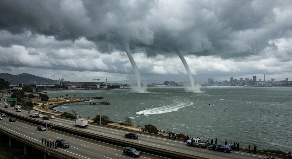
SAN FRANCISCO, CALIFORNIA — Commuters and residents along the San Francisco shoreline were treated to a rare meteorological display as twin waterspouts formed over San Francisco Bay near Candlestick Point and Highway 101.
The two rotating columns of air and water mist descended from dark storm clouds over the bay, remaining clearly visible to drivers traveling along the busy U.S. Route 101 corridor as well as onlookers along the southeastern waterfront. Photos and videos captured by startled motorists and local residents quickly circulated online, showing the pair of funnel clouds swirling side-by-side above the choppy waters.
Meteorologists explained that waterspouts typically develop when cold air moves over relatively warm water, creating atmospheric instability and strong updrafts that spin moisture upward into a visible funnel. While single waterspouts occasionally form off the Northern California coast during passing storm systems, seeing two appear simultaneously inside San Francisco Bay is an uncommon event.
Despite their dramatic appearance, the twin waterspouts remained entirely over the water and dissipated before reaching the shoreline. Local authorities and the National Weather Service confirmed that no injuries, vessel incidents, or property damage were reported in connection with the phenomenon.
Weather officials nonetheless reminded boaters and coastal residents to exercise caution during unstable weather conditions, noting that waterspouts can generate localized gusty winds and hazardous waves on the bay.
Traffic briefly slowed along northbound and southbound lanes of Highway 101 near Candlestick Point as drivers glanced toward the bay to catch sight of the unusual twin formations. California Highway Patrol officers monitored the corridor to ensure motorists kept moving safely and avoided pulling over onto narrow highway shoulders to film the weather event.
According to regional weather historians, fair-weather waterspouts of this kind are generally weaker than tornadic waterspouts associated with severe supercell thunderstorms, typically lasting only a few minutes before losing energy. Even so, the National Weather Service issued a special marine statement advising small craft operators across the central and southern bay to remain alert for sudden wind shifts and brief squalls.
As the storm cell moved eastward across the East Bay, skies over San Francisco gradually cleared, leaving behind calm waters and a memorable spectacle for Bay Area residents. Local meteorologists encouraged anyone who captured clear footage of the event to share timestamps and locations with weather officials to help document the rare bay sighting.
Published by Banx Network. This article is part of the Banx decentralized media programme, powered by the BXE token on the XRP Ledger.