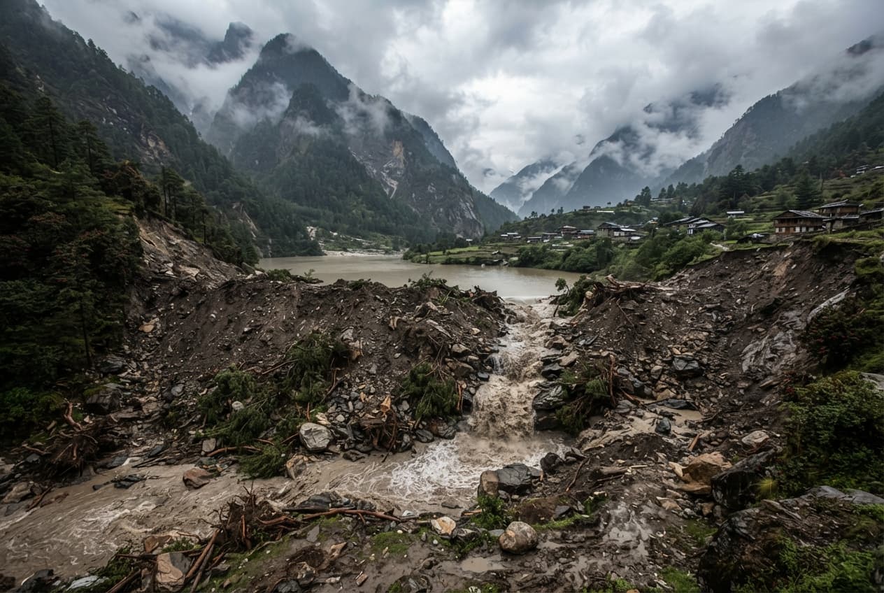
Mangan, India—A massive hillside collapse tore through a remote mountain pass in Sikkim's Mangan district during the early morning hours, partially damming two converging Himalayan rivers. The geological failure occurred along a newly excavated section of roadway in the Naga Forest area, sending thousands of tons of rock and mud crashing downward. The resulting debris avalanche choked the confluence where the Teesta and Chyakoong rivers meet near the base of the local infrastructure project. District police patrols rushed to the site before sunrise, establishing observation posts to track rising water pooling behind the earthen barrier.
Initial reports from the district disaster management cell confirmed that no immediate casualties or structural injuries occurred directly beneath the slide zone. However, engineers warned that the partial blockage created an unstable upstream reservoir that could burst if heavy rains persisted across the high-altitude watershed. Downstream communities received urgent evacuation warnings via local police control rooms as a precaution against sudden flash flooding. Hydrological monitoring stations downstream reported that water levels remained near normal baselines, though current flows turned heavily silted and opaque.
State engineering teams dispatched geotechnical inspection units equipped with drone cameras to assess the structural integrity of the remaining slope. Geological experts noted that months of unseasonal monsoon saturation severely destabilized the shale foundation above the roadway cut. Heavy earth-moving machinery was staged at a safe distance, waiting for clearance from safety officers before attempting to clear the blocked river channels. "Our primary focus right now is continuous water level observation to protect downstream habitations from sudden surges," stated a senior district administration officer.
The disruption halted all vehicular transit along critical mountain supply routes connecting remote interior settlements with the state capital. Transport trucks carrying essential food supplies and fuel reserves sat parked in long lines behind police barricades. Local villagers gathered near safe vantage points overlooking the river gorge, watching anxiously as muddy water swirled around the debris dam. District authorities coordinated with paramilitary border units to establish alternative foot trails for emergency personnel moving supplies across the ridge.
Environmental groups pointed to unscientific road widening projects and aggressive slope cutting as primary catalysts for the recurring landslide disasters in the fragile Himalayan belt. State infrastructure boards defended the construction timeline, citing vital strategic requirements for year-round military and civilian transport access. Independent geologists warned that seismic micro-fractures throughout the mountain pass would likely trigger additional collapses during future rain events.
Emergency response teams reinforced lower riverbank embankments with sandbags and concrete barriers as daylight illuminated the full scale of the slide. Communication lines running parallel to the highway remained severed, forcing rescue teams to rely on satellite radio links for coordination. District commissioners scheduled an emergency review meeting with disaster management stakeholders to formulate a long-term clearance strategy. The mountain pass remained closed indefinitely as monitoring sensors continued to record minor, ongoing rockfalls along the upper ridge.
Published by Banx Network. This article is part of the Banx decentralized media programme, powered by the BXE token on the XRP Ledger.