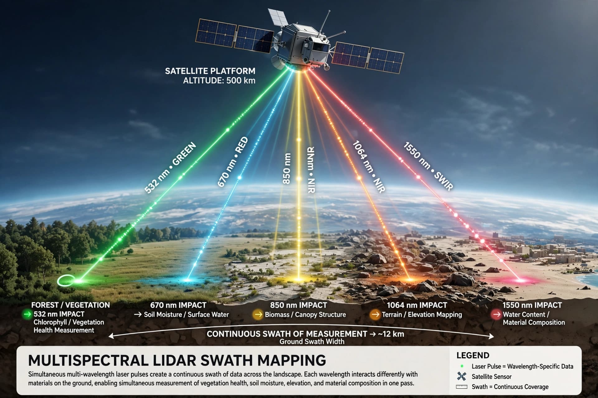
There is a particular kind of blindness that comes from looking at the world one line at a time, a limitation so fundamental that it has shaped the way scientists see the planet for decades. Space-based laser instruments, called lidar, measure Earth's forests and terrain by sending pulses of light downward and timing their return. But they do it in narrow tracks, leaving enormous gaps between the lines—millions of acres of land that are never directly measured. NASA's CASALS instrument, developed at Goddard Space Flight Center, is designed to close those gaps by painting a continuous swath instead of a single stroke.
The technology is a departure from the way lidar has traditionally worked. Rather than mechanically steering a laser with moving mirrors—a heavy and failure-prone approach—CASALS steers light using wavelength itself. A fast-pulsing, tunable "seed" laser cycles through 256 unique wavelengths, each of which diffracts at a slightly different angle when it passes through a transmission grating. The result is a fan of pulses that sweeps across the flight path, building a three-dimensional rendering of the ground below without a single moving part . "This non-mechanical approach paints a continuous 3D swath of the ground," the NASA team explained, eliminating the unmapped gaps left between the isolated tracks of legacy spaceborne lidars .
The detector array is equally important. CASALS operates at 80 percent quantum efficiency, meaning it converts incoming photons into electrical signals with almost no loss. That sensitivity allows it to detect weaker return signals, collecting useful measurements from darker surfaces or through denser vegetation . In November 2024, an airborne prototype flew aboard NASA's B200 King Air aircraft and produced science-quality datasets on its first campaign, exceeding the team's expectations. Flying at roughly five kilometers, it could distinguish individual tree branches and subtle changes in ground elevation, with a horizontal resolution of about 22 centimeters .
The implications for Earth science are substantial. The 2017 National Academies Earth Science Decadal Survey identified Surface Topography and Vegetation as a targeted observable, calling for high-resolution, global measurements to understand how landscapes evolve. Current lidars like ICESat-2 and GEDI have provided valuable data, but their profiling approach leaves gaps that models must interpolate. A swath-mapping instrument would provide direct measurements across entire regions, improving estimates of forest biomass, carbon storage, and terrain change .
There is a practical path from the airborne prototype to space. The team plans to widen the instrument's swath and add onboard data processing software before creating a space-ready version. CASALS is scheduled to fly again in the summer of 2027 as part of the ASCENT campaign . If successful, it could become the first spaceborne lidar capable of mapping Earth's forests and terrain as continuous three-dimensional swaths, giving scientists a dramatically more complete picture of a changing planet.
For now, the work is incremental: wider swaths, better software, more flights. But the direction is clear. The line-by-line blindness that has limited space-based lidar is not a permanent condition. It is an engineering problem, and CASALS is the beginning of its solution.
AI Image Disclaimer: The imagery in this article is generated by artificial intelligence and is intended for illustrative purposes only.
Sources: NASA Science, NASA NTRS, EGU General Assembly
Published by Banx Network. This article is part of the Banx decentralized media programme, powered by the BXE token on the XRP Ledger.