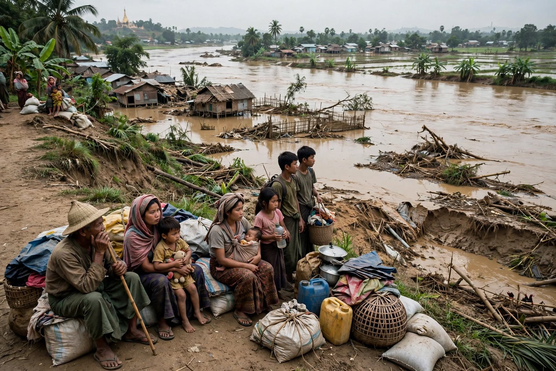
Pathein, Myanmar— The bank gave way at noon on October 30, 2026. After weeks of monsoon rain and high water on the Irrawaddy and Ngawun rivers, a 120-meter section of riverbank collapsed near Pathein and Laymyatna Township in Ayeyarwady Region, dragging waterfront dwellings, wooden stilt houses and a section of access road into the brown flood. Families had been watching cracks widen for days.
The Myanmar Health Cluster Bulletin dated October 30 said widespread flooding and landslides in Ayeyarwady, Tanintharyi and Yangon caused displacement and damage, increasing risk of landmine movement due to moving explosive ordnance. In July, an embankment near Myit Kyo Village in Laymyatna Township breached and floodwaters entered town rapidly. Water levels in the Ngawun remained above danger level into October. This latest collapse was the same system failing again.
In waterfront wards, houses are built on alluvial islands and soft banks. When the river rises, the toe of the bank erodes. Cracks appear at the top, as deep as a man's height, and 38 houses were reported destroyed in March after a 7.7 magnitude quake cut through Thanbokyun village on an island in the Ayeyarwady. That quake weakened banks already stressed by flood. Monsoon finished the job.
"There were not enough boats to rescue us," said a rescue worker in Taungoo during September floods on the Sittaung River, where over 300 people were trapped on the eastern bank. Similar scenes repeated in Pathein. Residents said they heard a low thump, then houses tilted and slid. A shopkeeper lost his entire stock when the floor fell into the river. No official death toll was released, but local officials said at least eight died in Tanintharyi on September 28 when flash floods buried homes.
The friction is in control and access. Myanmar's flood response is fragmented by conflict and damaged infrastructure. More than 50,000 people evacuated in central Myanmar in August after a dam on Swar Creek failed at 5:30 a.m., inundating Swar and several settlements. In September, Typhoon Yagi forced over 230,000 to evacuate, killing at least 226, with 77 still missing, according to state media. Roads and bridges are damaged, so aid is slow.
AP reported that four areas were declared disaster zones earlier in the season, with more than 330,000 affected and the death toll at 74 from monsoon floods and landslides. In Shan State, mountain runoff triggered by heavy rain forced evacuation of 2,267 people from 461 households in Yatsauk, Aungban, Kalaw and Pindaya. Those floods were early Monday events, but the pattern persists into late October.
By October 30, 2026, water was still high. Families whose houses went into the river camped on higher ground near the pagoda road. Myanmar Now correspondents said access was blocked because the collapsed bank took the road with it. Health workers warned of malaria and dengue rising in flood-hit endemic areas like Tanintharyi, Kachin and Sagaing.
The river had not yet peaked.
Published by Banx Network. This article is part of the Banx decentralized media programme, powered by the BXE token on the XRP Ledger.