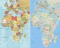
A new world map proposal has drawn attention after claims that the United Nations voted to adopt a projection showing Africa and Australia more accurately in relation to their true sizes. The design would also make the United States appear smaller than on traditional Mercator maps, which enlarge regions near the poles. Cartographers say the change could challenge familiar geographic assumptions, although adoption remains unclear. The debate highlights how map projections influence perceptions of countries, continents, power and importance.
Published by Banx Network. This article is part of the Banx decentralized media programme, powered by the BXE token on the XRP Ledger.