Key Highlights
- Location:A massive sinkhole collapsed in a rural village in Oaxaca, Mexico.
- Impact:The collapse displaced twenty families and damaged local infrastructure.
- Response:Emergency services are providing aid and monitoring geological activity.
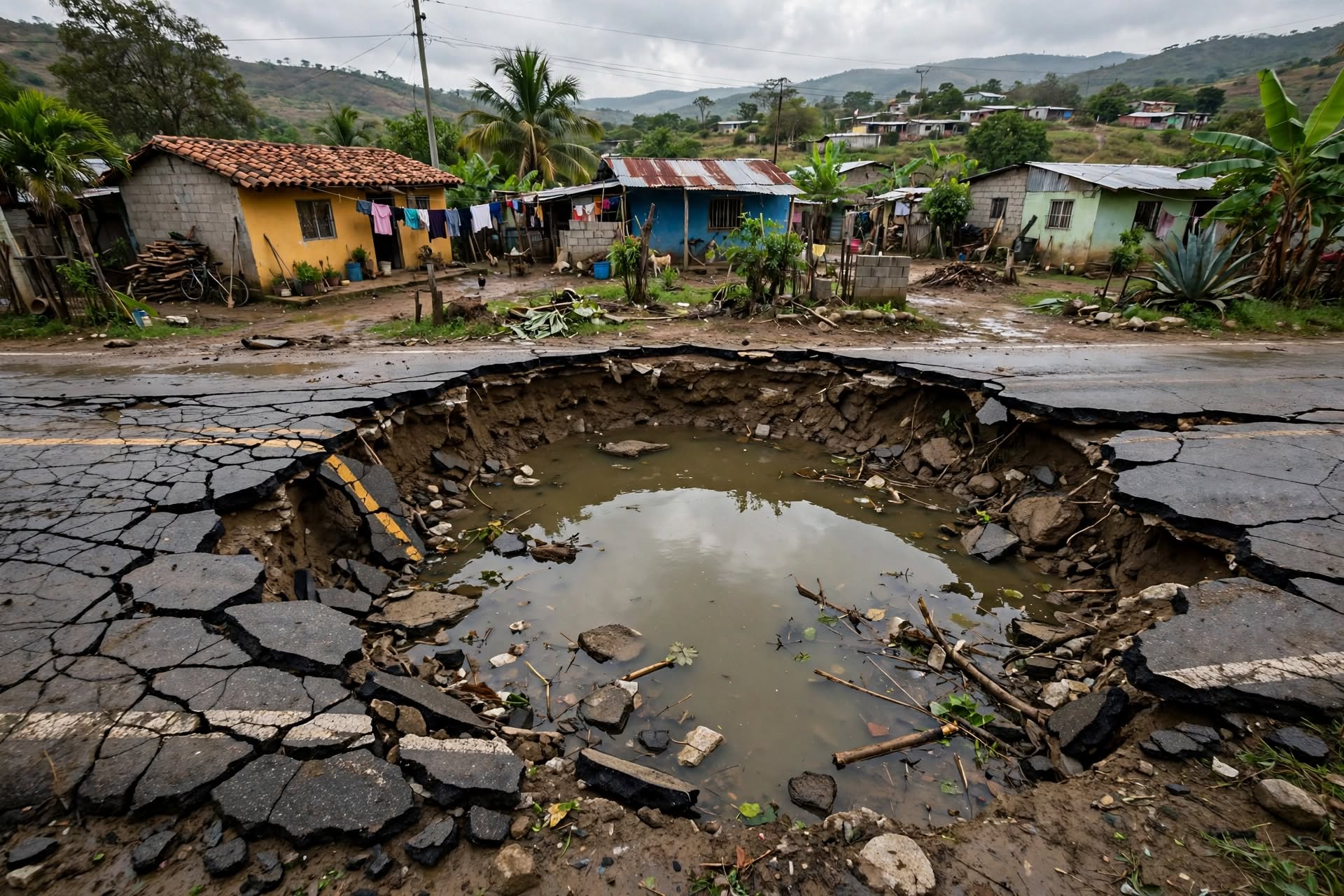
A massive sinkhole collapsed without warning inside a small rural village in southern Mexico on Thursday morning, following several days of intense precipitation. The geological collapse swallowed an agricultural storage barn and fractured a secondary asphalt road, creating a widening crater filled with churning groundwater. Municipal emergency units immediately evacuated twenty nearby families as ground fractures spread toward residential structures.
Geologists dispatched to the site confirmed that heavy rainfall saturated fragile underground limestone strata, causing subterranean caverns to collapse under heavy water weight. The crater expanded rapidly throughout the morning, with large chunks of topsoil shearing off the perimeter walls every few minutes. Local police established a five-hundred-meter security cordon around the active rim to keep curious residents at a safe distance.
Civil protection officers conducted door-to-door inspections across adjacent streets, checking residential foundations for micro-fractures and structural shifting. Paramedics established a field command station near the village chapel, treating several elderly residents for acute anxiety and minor injuries sustained during early morning evacuations. Utility technicians disconnected local water mains and electrical lines to prevent secondary pipe ruptures and electrical fires.
Displaced residents gathered inside a municipal community center on higher ground as local authorities distributed temporary bedding and emergency food supplies. Village leaders expressed frustration over long-standing complaints regarding underground water erosion along the rural corridor. Agricultural workers reported that lost storage facilities contained several tons of harvested grain and vital farming equipment.
State civil defense directors ordered continuous seismic monitoring around the perimeter using ground-motion sensors to detect subterranean collapses before they break the surface. Technical crews deployed aerial surveying drones to calculate the precise volume and expansion rate of the expanding pit. Preliminary aerial imaging indicates the crater measures over fifty meters across and continues to undercut nearby road embankments.
Municipal engineers shut down groundwater pumping wells across the immediate sub-district to prevent further water table destabilization. Hydraulic experts noted that heavy agricultural runoff combined with natural limestone erosion created the ideal conditions for a catastrophic structural surface failure. Environmental inspectors are sampling water inside the crater to check for contamination from ruptured septic tanks.
State government representatives promised emergency financial aid and temporary housing support for families whose properties fall within the hazard zone. Public works crews began unloading concrete barriers along secondary access roads to prevent heavy vehicles from driving over compromised soil sections. Authorities warned that road closures along the primary village access route will remain in effect indefinitely.
Geological survey teams will remain stationed at the collapse site overnight to track rim erosion and subterranean movements using specialized monitoring equipment. Emergency responders plan to expand the security perimeter if ground sensors detect further structural deterioration around the crater rim tomorrow morning.
Published by Banx Network. This article is part of the Banx decentralized media programme, powered by the BXE token on the XRP Ledger.