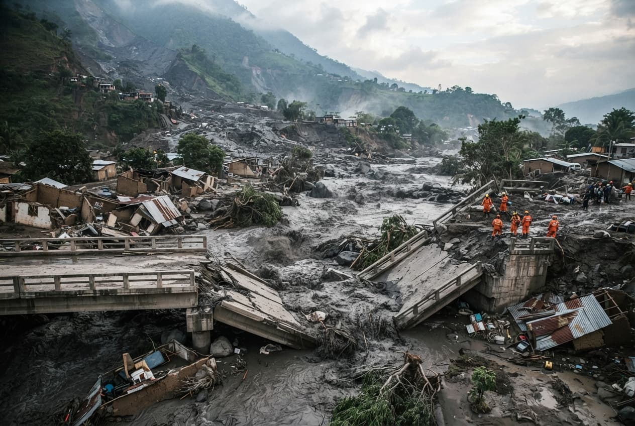
Guatemala—A thick, scalding slurry of volcanic ash, rock, and melted glacial ice surged down the mountain flanks without warning, obliterating village infrastructure in its path. The destructive lahar crashed through rural river channels at high speed, snapping reinforced concrete bridges and sweeping away utility poles like matchsticks. Sirens wailed across neighboring settlements, prompting terrified residents to flee on foot toward higher ground before the main wave arrived.
Volcanological institute monitors recorded sudden seismic tremors preceding the massive mudflow, which was triggered by heavy seasonal rains mixing with fresh summit ash deposits. Local disaster response agencies had maintained a yellow alert status, but the sheer velocity of the descending lahar caught local defense committees off guard. Mud and debris breached reinforced earthen dikes within minutes, spilling over agricultural lands and inundating rural homes.
Emergency evacuation buses lined up along the highway outside the hazard zone, ferrying displaced families to temporary shelters set up in municipal gymnasiums. Municipal authorities cut off drinking water supplies from the local river intake after tests confirmed heavy contamination from sulfur and heavy volcanic particulates. Medical teams treated scores of patients for respiratory distress caused by fine airborne ash swirling in the humid air.
Engineers inspecting the remains of the main concrete bridge noted that the sheer kinetic force of the rolling boulders had sheared the foundational pylons completely clean. Electrical transformers exploded in brilliant blue flashes as the mud wall knocked down high-tension power lines, plunging the entire valley into darkness. National guard units deployed armored transport vehicles to assist civil defense workers in navigating roads choked with grey sludge.
Community leaders expressed deep frustration over the failure of early-warning sensors installed along the upper ravines, which malfunctioned during the initial impact. Government ministers rushed to the regional crisis center to coordinate rescue logistics and assess the staggering cost of rebuilding damaged public infrastructure. International seismological experts offered support as satellite imagery revealed ongoing instability along the upper volcanic crater rim.
Agricultural losses mounted rapidly as acres of staple crops were buried under a sterile crust of gray volcanic sediment that rendered the soil temporarily unfarmable. Relief agencies distributed face masks, bottled water, and blankets to families huddled outside makeshift community centers under a dark, ash-strewn sky. Search teams utilized thermal imaging drones to scan the river banks for anyone trapped or isolated by the altered water channels.
Geologists warned that subsequent rainfall over the next several days could easily mobilize remaining ash deposits into secondary lahars of equal or greater magnitude.
Military engineers established a heavy exclusion zone around the devastated river basin while cleanup operations awaited clearance from hazard monitoring teams.
Published by Banx Network. This article is part of the Banx decentralized media programme, powered by the BXE token on the XRP Ledger.