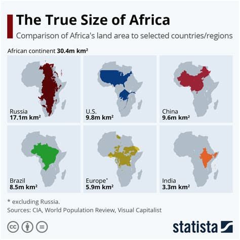
The United Nations has voted to adopt a new world map designed to represent Africa’s actual size more accurately. The change addresses distortions created by the widely used Mercator projection, which enlarges regions near the poles while shrinking Africa relative to other continents. Supporters say the revised map will improve geographic education, public understanding, and visual fairness. The decision also renews debate about how maps shape perceptions of history, power, and global importance, encouraging institutions to present geography with greater accuracy and context.
Published by Banx Network. This article is part of the Banx decentralized media programme, powered by the BXE token on the XRP Ledger.