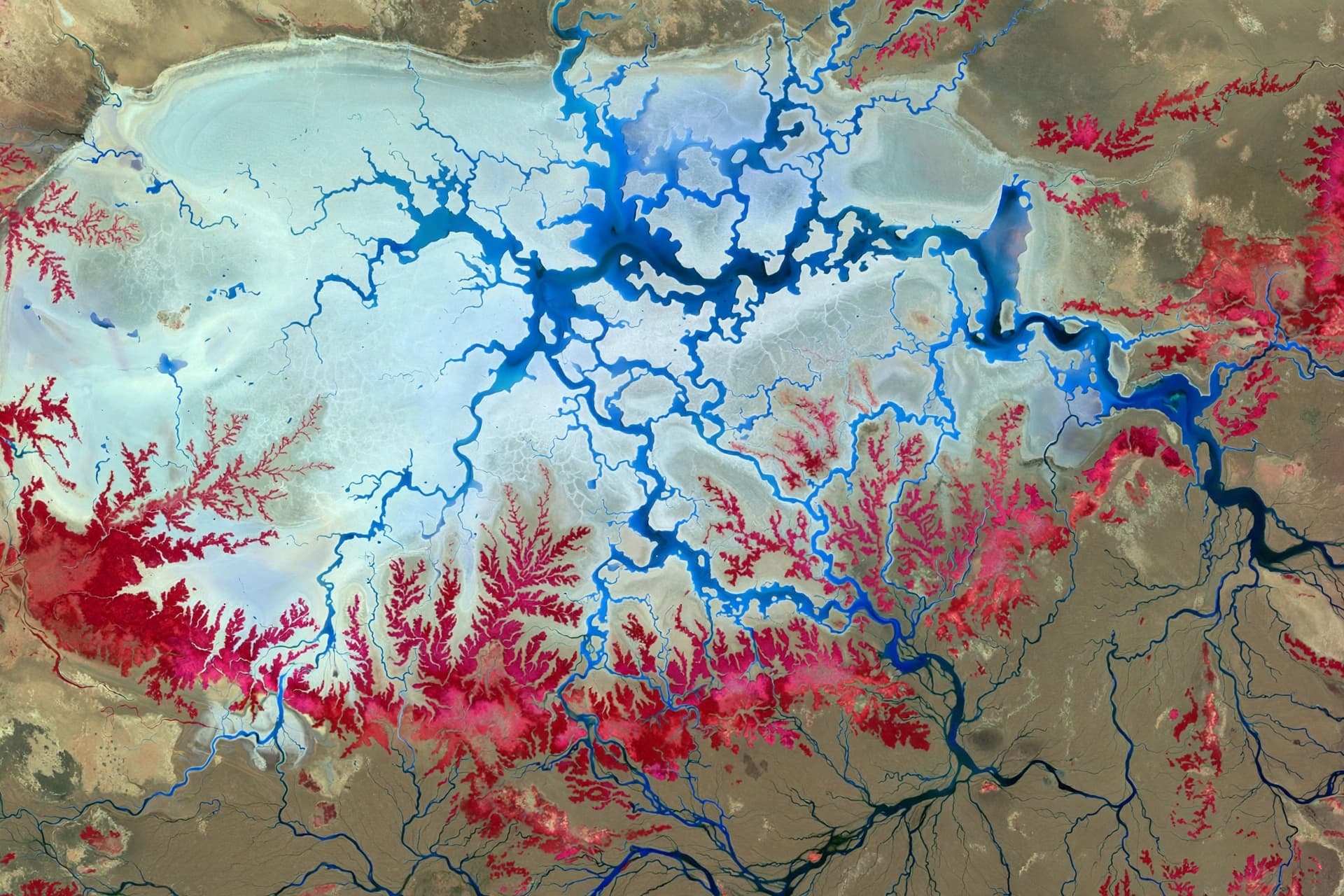
There is a particular kind of beauty that only reveals itself from a distance—a beauty that depends on the eye being far enough away to see patterns that the ground itself cannot show. From the perspective of a satellite orbiting hundreds of kilometers above the Earth, the Etosha Pan in northern Namibia does not look like a salt flat at all. It looks like something dreamed by a science fiction artist: a neon blue pool swirling with what appear to be clouds, surrounded by a bright red stretch of land that could belong to another world entirely .
The image, captured on April 5, 2026, by the European Copernicus Sentinel-2 mission, is not a photograph in the way most of us understand the term. It is a false-color composite, a rendering created from data collected across thirteen different spectral bands—wavelengths of light that human eyes cannot perceive . What the satellite sees, and what scientists need to see, is not what we would see if we stood on the pan itself.
Standing on the Etosha Pan, a visitor would find a vast expanse of bright white, a landscape of salt and minerals dried by the sun . The pan is the largest in Namibia, a country in southwestern Africa known for its dramatic deserts and wildlife. It stretches roughly 130 kilometers from east to west and covers approximately 4,760 square kilometers . In the rainy season, it can fill with a thin layer of water; in the dry season, it becomes a shimmering, cracked plain.
The false-color processing transforms this landscape into something almost abstract. Vegetation—grasslands, savannas, and mopane trees—appears in vivid red . The salt pan and any water it holds take on shades of blue, from pale cyan to deep cobalt. The result is an image that seems to depict an alien terrain, but is in fact a precise scientific document. Each color corresponds to a specific type of surface, a specific range of wavelengths, and a specific piece of information about the land.
This is not aesthetic manipulation for its own sake. The Sentinel-2 mission was designed to monitor Earth's surface with high resolution and frequent revisit times, tracking changes in vegetation, water, and land use . False-color composites allow researchers to distinguish between types of vegetation that might look identical in true color, or to detect the presence of water in places where the eye would see only dry ground. The striking blues and reds of the Etosha image are, in a sense, a form of translation—converting invisible data into a visual language that scientists can interpret.
The Etosha Pan is more than a geological curiosity. It is part of Etosha National Park, one of Africa's great wildlife reserves, home to elephants, giraffes, and leopards . The pan itself, when it holds water, attracts flamingos and other waterbirds. The vegetation that appears red in the satellite image provides shelter and habitat for these animals. The image, for all its otherworldly appearance, is a portrait of a living ecosystem.
For those who study Earth from space, images like this one serve a dual purpose. They are tools for science, revealing patterns and changes that would otherwise remain invisible. And they are reminders—aesthetic, almost philosophical—that our planet is stranger and more beautiful than we often remember. From the ground, the Etosha Pan is a white expanse under a vast sky. From orbit, it becomes a blue and red vision, a reminder that perspective changes everything.
AI Image Disclaimer: The visual content in this article is AI-generated and is intended for illustrative purposes only.
Sources:
· Space.com
Published by Banx Network. This article is part of the Banx decentralized media programme, powered by the BXE token on the XRP Ledger.