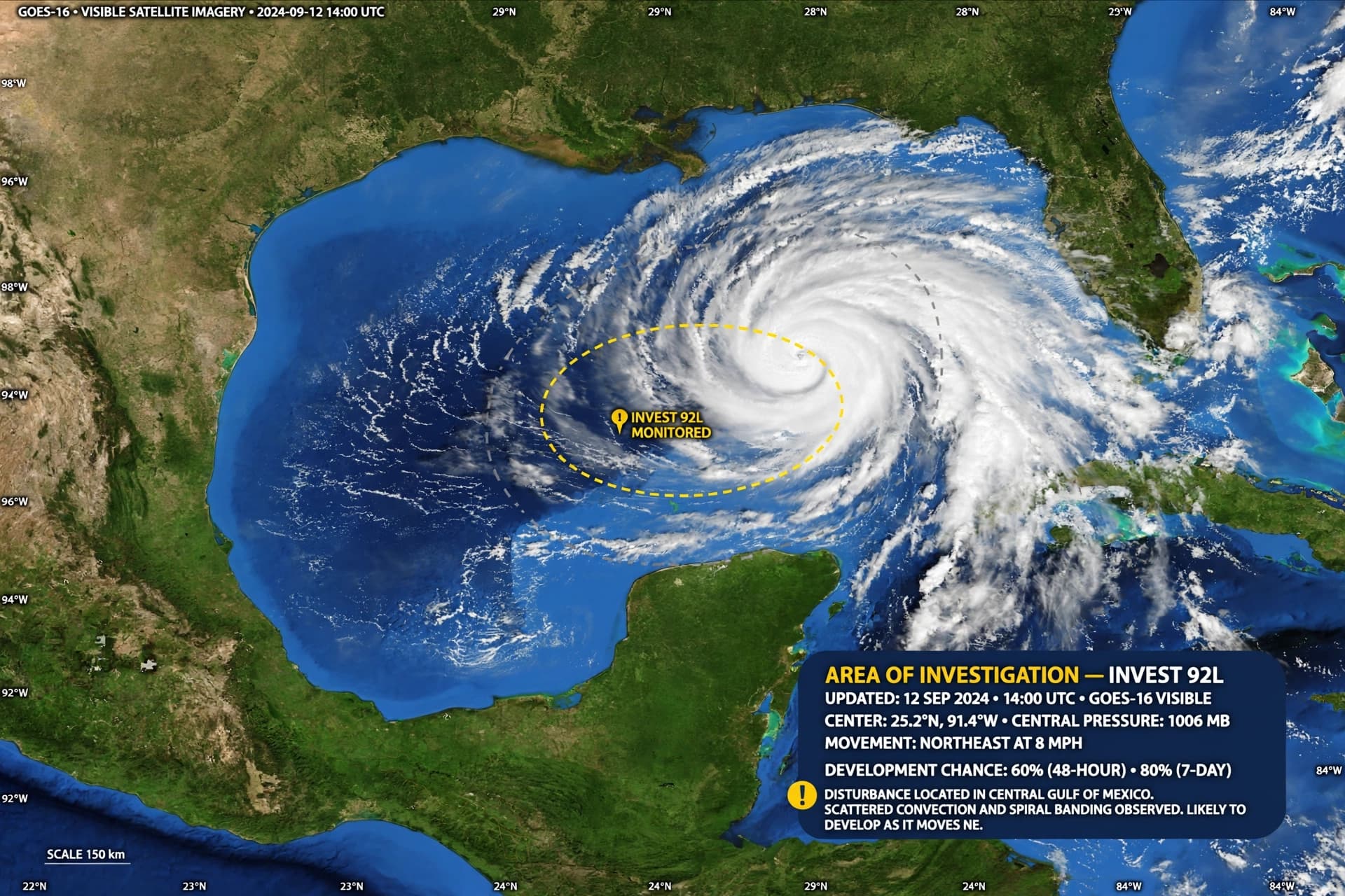
There is a particular vigilance that settles over the Gulf Coast in October—a vigilance that comes not from the peak of the season but from the knowledge that the season is not yet over, that warm waters and favorable winds can still conspire to create something dangerous. On Monday, the National Hurricane Center designated a broad area of low pressure in the southwestern Gulf of Mexico as Invest 92-L, a designation that means the system is being actively monitored for potential development. As of Monday afternoon, the disturbance had a 60 percent chance of becoming a tropical depression or storm within 48 hours, and an 80 percent chance within seven days .
The system, currently a trough of low pressure producing disorganized showers and thunderstorms near the Bay of Campeche, is expected to drift eastward over the next couple of days before turning northward. Forecasters warn that regardless of whether it earns a name—which would be Isaias—the system could bring periods of heavy rain, gusty winds, and rough marine conditions to parts of the Gulf Coast by the weekend . The National Weather Service in Slidell, Louisiana, said the big question is how the system interacts with a trough over Texas. Some models project it will be pulled northeast toward the central Gulf Coast, while others keep it stuck in the southwest Gulf .
What makes this system particularly notable is the context in which it has formed. The 2026 Atlantic hurricane season has been unusually quiet. More than 300 days have passed since the last hurricane formed, and September ended without a single hurricane for the first time in 32 years, suppressed by a strong El Niño pattern . If the season ends without a hurricane, it would be only the third such occurrence on record. But October is still an active part of the season, and systems that form in the western Gulf can develop quickly as they move over warm water. Sea surface temperatures in the Gulf are roughly 0.5 degrees Celsius higher than in any other year on record for this date .
Forecasters caution that there is still considerable uncertainty. Until a well-defined circulation develops, models have no established center to track, and individual runs may show significantly different solutions. Wind shear is expected to increase across the northern Gulf later in the week, which could prevent anything stronger from developing . But even without a named storm, the system could produce heavy rainfall—a broad 4 to 8 inches from southeastern Louisiana into North Florida, with pockets of 10 inches or more possible
Residents from the northern Gulf Coast westward toward Texas and Louisiana are urged to monitor forecast updates as the disturbance becomes better organized. The system is expected to remain well west of Central Florida for now, but conditions can change quickly . The next few days will be important in determining whether Invest 92-L can organize into the season's next named system. For now, the Gulf is being watched, and the watches will continue.
AI Image Disclaimer: The visual elements in this article were created using AI generation tools and are intended for illustrative purposes only.
Sources: WESH, FOX8, Geo.tv, Yale Climate Connections, WeatherTiger, CBS12
Published by Banx Network. This article is part of the Banx decentralized media programme, powered by the BXE token on the XRP Ledger.