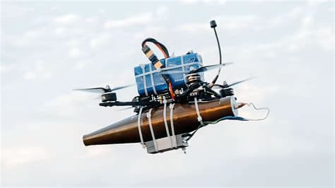
From above, a city appears as a calm pattern. Roads become lines, buildings turn into shapes, and people look small amidst the vast spaces. However, for an unmanned aerial system, that view can transform into a continuous stream of data.
Morocco is now looking at the broader possibilities of using unmanned aerial vehicles or UAVs. It’s not just about how many drones can be flown, but how images, videos, coordinates, and sensor information collected from the air can be transformed into useful information.
This development coincides with the increasing capabilities of UAVs in the public safety sector. At the 2026 Open Days event, the General Directorate of National Security (DGSN) of Morocco showcased various categories of UAVs, including Moroccan-made vertical-takeoff-and-landing drones designed to support surveillance and field interventions.
This is where artificial intelligence begins to find its place. A drone can generate thousands of images or recordings in one operation, but it is impossible for humans to examine every piece of data with the same level of attention. AI can help filter that information and highlight parts that may require further inspection.
In simple terms, AI systems can assist in recognizing visual changes, finding specific objects, or marking conditions that differ from previous patterns. Regular cameras can show the state of a location, while thermal data, geographic coordinates, and historical recordings can provide additional layers of information.
That potential becomes increasingly relevant for various needs such as search and rescue, infrastructure monitoring, disaster management, surveillance of hard-to-reach areas, and emergency situations. The advantage of UAVs lies in their ability to observe specific locations repeatedly without always placing personnel in risky positions.
However, more data does not always mean that decisions become easier. On the contrary, an information flood can create new problems. Therefore, the role of AI is better understood as an analytical layer that helps humans determine which information should be prioritized.
Morocco has also demonstrated a direction towards modernizing security technology through smart patrol vehicles that utilize recognition systems, cameras, integrated drones, and AI technology. This development shows that the use of aerial technology is starting to be placed within a broader technological network, rather than as standalone devices.
But ultimately, technology still requires humans to provide context. A shadow may look like an object, heat can have many causes, and a recognition system can produce errors. Therefore, the use of AI in UAVs requires human oversight, validation, data security, and a clear framework for use.
Thus, the future of UAVs in Morocco may not only be determined by the number of drones in the air. More importantly, it is how cameras, sensors, communication networks, AI, and humans can work together as a single information system. From the sky, data is collected; on the ground, humans still determine how that data is understood.
Image Disclaimer: This visual is a conceptual illustration created with the help of AI to depict the development of UAV technology and artificial intelligence, not a photo of real events.
Sources:
Morocco World News General Directorate of National Security (DGSN) National Institute of Standards and Technology (NIST)
Published by Banx Network. This article is part of the Banx decentralized media programme, powered by the BXE token on the XRP Ledger.