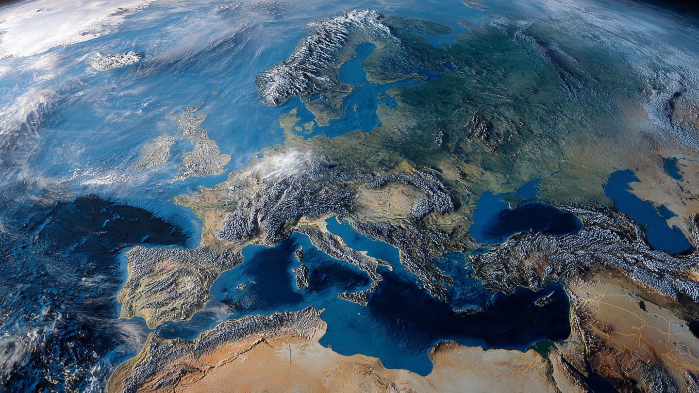
From hundreds of miles above the Earth, borders disappear.
Mountain ranges stretch across nations without interruption. Rivers wind through valleys unconcerned with politics. Coastlines trace familiar curves into surrounding seas. Seen from orbit, Europe appears as a single landscape—an intricate tapestry of forests, cities, plains, and water shaped by geography more than by human design.
Yet from that same vantage point, another pattern has become increasingly visible: heat.
A striking satellite image released as part of a "Space Photo of the Day" feature captured Europe during a record-breaking heat wave, offering a perspective rarely available from the ground. While people experienced the event through sweltering afternoons, crowded beaches, and warnings from local authorities, instruments in orbit observed the phenomenon on a continental scale, documenting how extreme temperatures spread across vast regions.
The image revealed more than weather. It illustrated a moment in which an entire landscape appeared to radiate under prolonged summer conditions, transforming familiar terrain into a visual record of atmospheric change. From orbit, the heat wave resembled a broad environmental event rather than a collection of local forecasts—a reminder that climate and weather often operate across distances far greater than those visible from any single city or community.
Across much of Europe, temperatures climbed to levels that challenged historical records. Southern regions endured particularly intense conditions, while areas farther north also experienced unusually high temperatures. Meteorologists linked the event to persistent high-pressure systems that trapped warm air over large portions of the continent, limiting cloud formation and allowing heat to accumulate day after day.
On the ground, the effects unfolded in countless ways. City streets shimmered beneath afternoon sunlight. Reservoirs and rivers faced increased stress from evaporation and reduced rainfall. Agricultural regions monitored crops carefully as prolonged warmth altered growing conditions. Emergency services prepared for heightened health risks, especially among vulnerable populations.
From space, however, these individual experiences merged into a broader picture.
Satellites have become some of humanity's most valuable witnesses to environmental change. Equipped with sophisticated sensors, they measure land temperatures, atmospheric composition, vegetation health, ocean conditions, and countless other indicators that help scientists understand how Earth's systems interact. Unlike observations limited to one location, orbital instruments provide a continuous view of patterns unfolding across entire continents.
The recent heat wave underscored the importance of that perspective. Scientists increasingly rely on satellite data to identify trends associated with extreme weather, assess drought conditions, and improve forecasting models. Images captured from orbit often serve not merely as photographs but as scientific tools, revealing relationships that may remain hidden at ground level.
The event also arrives amid broader discussions about climate variability and the increasing frequency of extreme heat episodes. Researchers have observed that heat waves are becoming more intense and more common in many regions of the world. While individual weather events arise from complex combinations of atmospheric conditions, long-term temperature trends have heightened concerns about how societies will adapt to changing environmental realities.
Europe has found itself at the center of many of these conversations. Recent years have brought episodes of drought, wildfires, flooding, and record-breaking temperatures, each illustrating different dimensions of a climate system under pressure. Governments, scientists, and communities continue debating how best to strengthen resilience while preparing for conditions that may become increasingly common in future decades.
Yet the satellite image carries a quieter message as well.
Viewed from space, humanity's responses to heat become almost invisible. The cooling systems humming inside buildings, the emergency plans activated by local authorities, the adjustments made by farmers and families—none can be seen directly from orbit. What remains visible is the landscape itself, absorbing sunlight, releasing energy, and responding to forces that operate across immense scales.
As another European evening settles over coastlines, villages, and cities, temperatures gradually begin to ease. Shadows lengthen. Streets become more active again. The rhythms of daily life continue beneath skies that reveal little of the immense atmospheric processes shaping conditions below.
Far above, satellites continue their silent journeys around the planet, collecting measurements and images with mechanical patience. They observe forests darkening at sunset, clouds forming over distant mountains, and continents warming beneath summer skies.
The record-breaking heat wave will eventually pass, as all weather does. Yet the image captured from orbit remains—a still frame from a season of extremes, preserved not merely as a photograph but as a reminder of how interconnected Earth's systems truly are.
From space, Europe appears unified beneath the same atmosphere. The heat that crossed its landscapes left a visible mark, one that speaks not only to a single summer but to a broader story still unfolding across the planet.
AI Image Disclaimer: These illustrations were generated using AI technology and are intended as visual representations of the topic rather than authentic satellite or news photographs.
Sources:
Space.com European Space Agency (ESA) Copernicus Climate Change Service World Meteorological Organization (WMO) Reuters
Published by Banx Network. This article is part of the Banx decentralized media programme, powered by the BXE token on the XRP Ledger.