
The sea around Papua New Guinea rarely stays entirely still. Even on calm mornings, the Pacific seems to breathe with quiet force — waves rolling against volcanic islands, fishing boats rising gently with the tide, clouds gathering above mountain ridges that emerge suddenly from the ocean. Beneath those waters, however, another landscape exists unseen: shifting tectonic plates, submerged ridges, and volcanic systems moving slowly through geological time.
This week, that hidden world surfaced violently.
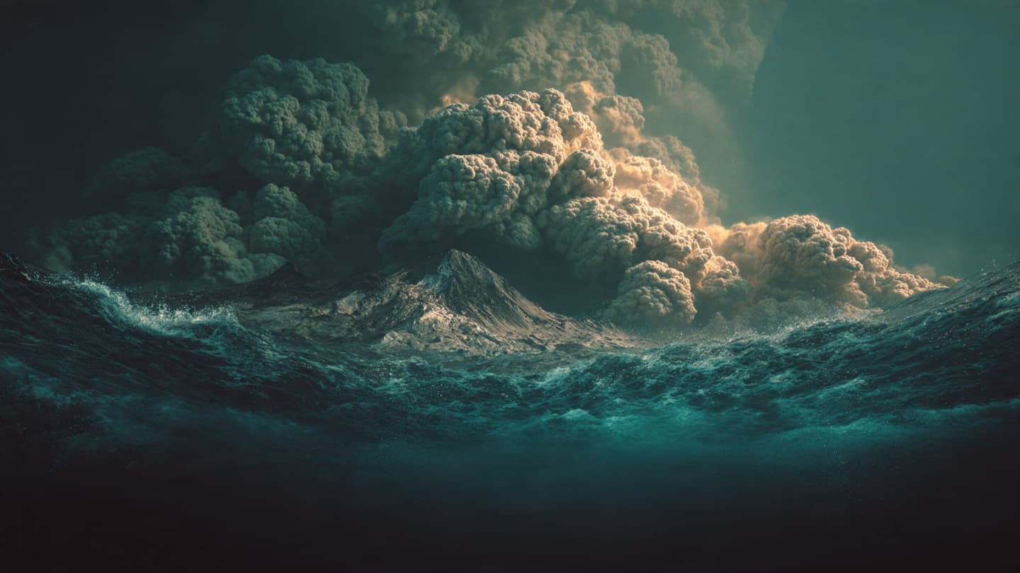
An undersea volcano erupted in the Bismarck Sea near Papua New Guinea, prompting tsunami concerns and renewed monitoring across parts of the Pacific region. Authorities and scientific agencies moved quickly to assess the scale of the eruption and evaluate potential risks to nearby coastal communities after seismic activity and underwater disturbances were detected beneath the ocean floor.
For residents living along Papua New Guinea’s shores, the warnings carried a familiar unease. The country sits along the Pacific “Ring of Fire,” one of the world’s most active seismic zones, where earthquakes and volcanic eruptions form part of the region’s natural rhythm. Many communities are accustomed to living with that uncertainty — an awareness that the sea and the earth can change suddenly, often without visible warning.
Initial reports suggested the eruption occurred beneath remote waters in the Bismarck Sea, northeast of mainland Papua New Guinea. Scientists monitoring the event observed volcanic activity and seismic movement capable of generating concern about possible tsunami waves, though authorities continued evaluating whether the threat would significantly affect populated coastlines.
In coastal villages and island settlements, such warnings alter the atmosphere quickly. Radios remain on longer than usual. Families gather near shorelines watching the tide. Local officials monitor emergency communication systems while fishing boats return earlier to port. Even when tsunami waves ultimately prove limited, the waiting itself becomes part of the experience — a quiet period of suspended uncertainty shaped by memory and geography.
Papua New Guinea occupies one of the most geologically active regions on Earth. Volcanoes rise both above and below the Pacific Ocean across an immense chain of islands where tectonic plates collide deep beneath the surface. Earthquakes occur regularly, and several volcanic eruptions over recent decades have displaced communities, disrupted air travel, and reshaped coastlines.
Yet submarine eruptions possess a particular mystery because much of their force remains invisible. Unlike towering ash plumes from land-based volcanoes, underwater eruptions often reveal themselves indirectly: through seismic readings, changes in ocean temperature, steam rising from the sea, or unusual wave activity spreading across distant shores. Scientists rely heavily on satellite monitoring and underwater sensors to interpret events occurring far below the surface.
The eruption also serves as a reminder of the Pacific Ocean’s immense interconnectedness. A geological disturbance beneath remote waters can prompt alerts thousands of miles away as neighboring countries monitor tides and seismic data. Tsunami systems across the Pacific Basin now operate with increasing sophistication, shaped partly by lessons learned from devastating past disasters in Indonesia, Japan, and elsewhere.
Still, technology can never entirely remove the emotional weight carried by coastal communities living beside active seas.
In Papua New Guinea, many villages remain deeply tied to the ocean through fishing, transport, and cultural traditions. The sea provides livelihood and connection, but also carries unpredictability. Storms, earthquakes, and volcanic events remain woven into local memory, passed between generations through stories of earlier eruptions and waves that altered entire shorelines.
Beyond the immediate emergency response, the eruption highlights broader environmental realities facing Pacific nations already navigating climate pressures, rising sea levels, and fragile infrastructure. Remote island communities often have limited access to evacuation routes, emergency services, or rapid communication systems, making preparedness especially important during natural disasters.
For scientists, events like this also offer rare opportunities to study Earth’s underwater volcanic systems more closely. Much of the planet’s volcanic activity actually occurs beneath the oceans, hidden from ordinary view. These eruptions shape new seafloor formations, influence marine ecosystems, and occasionally produce dramatic surface events capable of affecting shipping routes, fisheries, and coastal populations.
As evening settles over the Bismarck Sea and monitoring stations continue tracking seismic patterns beneath dark Pacific waters, uncertainty remains part of the horizon. Officials continue assessing risks. Coastal residents remain alert. Fishing boats rest quietly near shore while radios carry updates through humid tropical air.
And beneath the waves, far below where sunlight reaches, the restless geology of the Pacific continues its ancient movement — unseen, immense, and indifferent to human borders.
For now, the eruption serves as another reminder that in places shaped by ocean and fire, life often unfolds alongside forces far older and larger than the communities watching the tide from shore.
AI Image Disclaimer These images were created using AI-generated visuals intended to illustrate the environments and themes discussed in the article.
Sources Reuters Associated Press US Geological Survey Pacific Tsunami Warning Center BBC News
Note: This article was published on BanxChange.com and is powered by the BXE Token on the XRP Ledger. For the latest articles and news, please visit BanxChange.com