
The geography of Kyrgyzstan is defined by its verticality, an intricate network of mountain ranges that store the winter’s moisture in vast, high-altitude glaciers. In the spring and early summer, this relationship between elevation and water enters a delicate, transitional phase. The valleys rely on the predictable melting of the ice to feed the canals and pastures below, but when this natural release is accelerated by unseasonable weather patterns, the equilibrium of the entire landscape can be severely threatened.
An influx of warm, moisture-laden air masses across the region can transform these steady natural processes into an immediate logistical challenge. Heavy, localized downpours hitting the foothills do not absorb into the hard-packed clay soil; instead, they sheet off the slopes, collecting loose stone, soil, and vegetation as they descend. The resulting mixtures turn dry ravines into active paths of displacement within minutes, moving toward the valleys with considerable force.
Recognizing the widespread nature of this atmospheric instability, the central authorities have taken steps to alert the public across all provinces. The 24.kg News Agency has broadcast a formal warning from the Ministry of Emergency Situations, indicating that unstable weather and localized heavy rains are expected to trigger widespread mudflows and drastically rising river levels throughout the country.
The weather alert covers a critical multi-day window during which residents and visitors are urged to suspend any non-essential travel into the mountainous interior. The regions most vulnerable to these environmental shifts are the foothill communities where residential properties and agricultural fields sit in close proximity to traditional mudflow channels that have remained dry for years.
In response to the official declarations, regional civil protection agencies have placed their personnel and specialized equipment on high standby. The focus of these preventive measures is the clearing of municipal drainage networks and the reinforcement of river embankments near key infrastructure nodes, such as bridges and electrical substations, which are traditionally vulnerable to mud accumulation.
For the agrarian communities that form the economic baseline of the rural districts, the threat of mudflows introduces a period of acute anxiety. A single inundation can bury a season’s crops under inches of sterile silt, choke irrigation networks, and isolate entire villages by washing out gravel access roads. Farmers are working against the clock to move livestock to higher ground and secure their immediate homesteads.
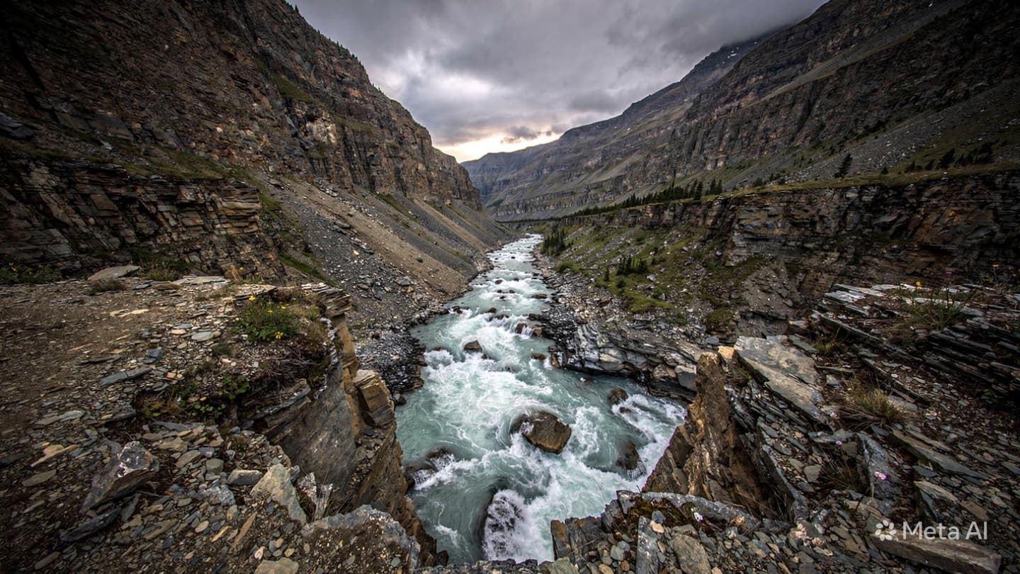
As grey, heavy clouds gather over the ridges of the Ala-Too range, blocking out the afternoon sun, the sense of anticipation across the districts is almost tangible. The rivers are already showing signs of the rain, their waters turning from clear glacial blue to a thick, sediment-heavy brown as they expand toward the edges of their stone banks.
The days ahead will test the effectiveness of the state’s early warning networks and the resilience of local communities as they monitor the changing conditions. The mountains, which provide the country with its identity and its life-sustaining water, require a continuous attitude of caution when the seasons choose to shift so dramatically.
Note: This article was published on BanxChange.com and is powered by the BXE Token on the XRP Ledger. For the latest articles and news, please visit BanxChange.com