
Jakarta, Indonesia—Volcanologists issued urgent regional hazard warnings on Friday morning after three separate volcanic peaks erupted overnight across the country's main tectonic belts. Mount Semeru in East Java, Mount Ibu in North Maluku, and Mount Ile Lewotolok in East Nusa Tenggara all experienced sudden explosive outbursts within a six-hour window. The Center for Volcanology and Geological Hazard Mitigation immediately expanded the mandatory exclusion boundaries.
The activity sequence began just before midnight when Mount Ile Lewotolok expelled a thick column of incandescent material into the southern sky. Local monitoring personnel recorded strong seismic tremors lasting for thirty-six seconds as the crater floor ruptured. Glowing rock fragments cascaded down the upper slopes, setting fire to sparse alpine brush inside the uninhabited zone.
Less than an hour later, Mount Ibu in Halmahera detonated, sending a dense gray ash plume six hundred meters into the atmosphere. Prevailing winds are currently driving the fine particulate cloud toward northeastern coastal villages, prompting the distribution of protective respiratory masks. Local disaster agencies have advised families to secure their outdoor clean water storage containers immediately.
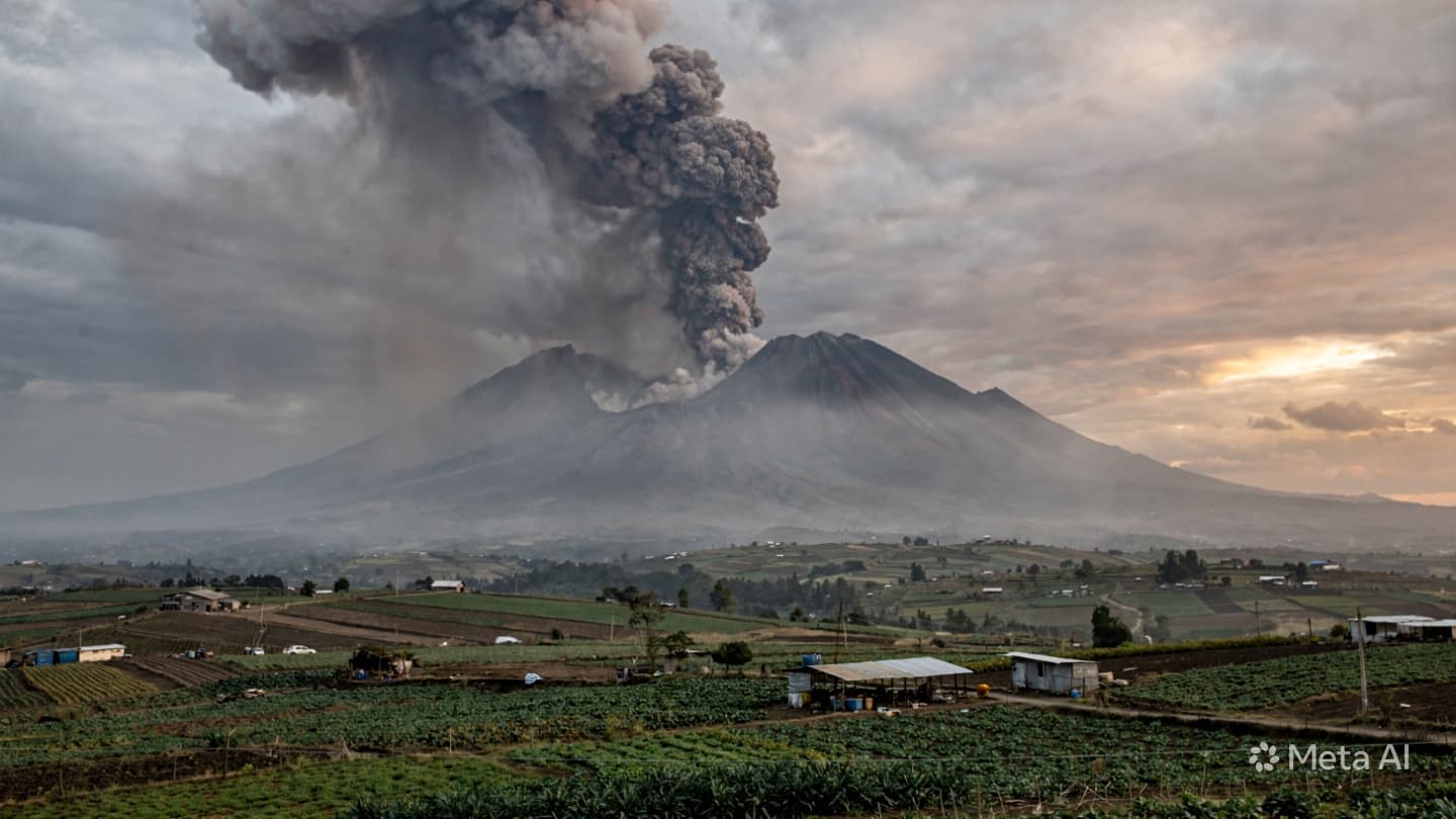
The largest individual blast occurred at Mount Semeru, where an ash column reached seven hundred meters above the summit before drifting northwest. The seismogram recorded a high-amplitude explosion that rattled windows in agricultural settlements located thirteen kilometers from the peak. Heavy truck traffic along the riverbeds was ordered to halt due to the high risk of rain-driven cold lava flows.
Emergency logistics teams are currently deploying temporary supply depots to handle potential displacement if the current activity indicators escalate. Local search and rescue units have established observation posts outside the critical three-kilometer danger rings to turn back curious travelers. Police barriers are blocking all standard hiking trails leading up the volcanic shoulders.
Aviation safety notices were upgraded to orange status for the affected regional flight corridors, forcing commercial carriers to alter their standard approach patterns. High-altitude ash can clog commercial jet engines, posing a major threat to inter-island transit routes. Traffic controllers are using real-time satellite tracking to reroute morning flights around the active plumes.
Agricultural departments are assessing the potential damage to vegetable crops in the high-altitude valleys surrounding the eruption centers. A thin layer of volcanic ash has already settled on terraced fields, which could ruin seasonal harvests if heavy rains do not wash the leaves clear. Farmers are scrambling to salvage ready crops before the air quality deteriorates further.
Government disaster coordinators are maintaining constant radio contact with the isolated observation stations located near the base of each mountain. The teams are tracking internal gas pressure levels and continuous volcanic tremors to determine if magma is moving closer to the surface.
Evacuation routes remain marked and cleared of debris as local transport networks prepare for potential emergency orders later in the week. The summits remain obscured by heavy smoke and ash as monitoring crews analyze incoming seismic data.
Note: This article was published on BanxChange.com and is powered by the BXE Token on the XRP Ledger. For the latest articles and news, please visit BanxChange.com